Privacy choices

Choose what we may use.

The site works without optional tracking. Your choice is saved on this device and can be changed here anytime.

Necessary

Runs the site, protects forms, and remembers this privacy choice.

Always on

Asset Search by PorchRocket

Find and monitor any asset you can see from above.

Asset Search by PorchRocket finds physical assets like tanks, ponds, towers, generators and domes anywhere in the lower 48 from aerial and satellite imagery checked against property records, and returns a reviewed list with the owner of record on every find.

For equipment makers and service companies, cities and utilities, ports, energy and site selection.

What do you want to find?

Anything you can see from above. Add size or type if it matters.

Where should we look?

Lower 48 as standard. Other regions on request.

Where should we send your scope and quote?

A person reads every request and replies with a written scope. Privacy

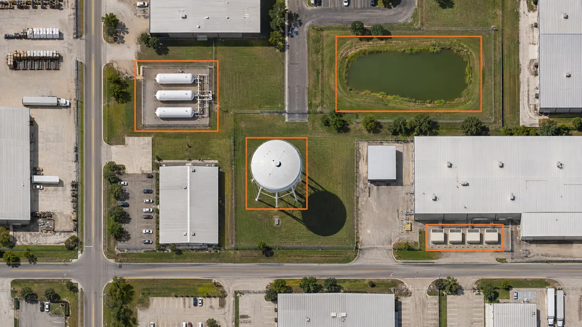
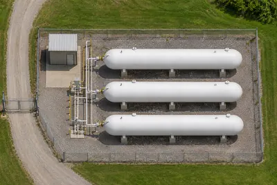
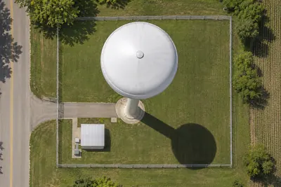
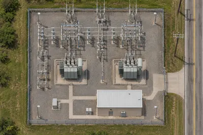
Illustrative aerial view of tanks, a pond, a water tower and generator enclosures.IllustrativeTanks, ponds, towers and generators
Visible assets. Reviewed answers.Owner of record on every find

The answer, with the evidence

What you get for every find

A dated view. Location and parcel. Owner of record. Observed facts. A person’s reviewed answer.

Illustrative example, not a customer record.
Asset and locationDated viewParcel and owner of recordObserved factsReviewed answer
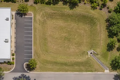
Fabric-covered domeExample site A, Ohio2026-05-14AerialIllustrative parcel AIllustrative parks departmentEnclosed cover and clear access.FitsMeets the agreed visible structure rules.
Fabric-covered domeExample site B, Ohio2026-05-14AerialIllustrative parcel BIllustrative private landownerOpen-sided canopy.RejectsOpen sides do not meet the enclosed-structure rule.
Fabric-covered domeExample site C, Ohio2026-05-14SatelliteIllustrative parcel CIllustrative municipal ownerRoof visible; cover material unclear.UnresolvedField check: confirm whether the roof cover is fabric.

CSV · Excel · GIS-ready files · CRM or dealer import

Download an illustrative sample file

Find your next customer or site

Map the market you sell into

For manufacturers, service companies, dealers and site selection teams. Find the equipment and sites you do not own, with the evidence to decide where to go next.

Send your installed-base list after we reply and we return only what's new

Know what is there and what changes

Inventory and watch what you own or regulate

For cities, utilities, ports and energy operators. Complete inventories in your GIS format, with change reports that show what is new, removed or altered.

Your area, your rules, your working format.

From a question to a useful file

How it works

  1. 01

    Set the rules

    Tell us what fits. We define the visible features and edge cases with your experts.

  2. 02

    Find candidates

    We search your area using aerial and satellite views and property records.

  3. 03

    Review the evidence

    A person checks every result against your rules before it ships.

  4. 04

    Send the answers

    Get the evidence, the owner of record and a reviewed answer in your format.

Licensed aerial and satellite imagery, checked against property records. Every row shows the date and type of its view. If the newest view of your area is older than you need, your scope says so before you pay.

A person checks every result against your rules before it ships.

What we cannot confirm from above comes back Unresolved, with the one field check that settles it.

Choose the cadence your area supports

Find it once, or keep watch

01

One-time

A reviewed list for the area and rules you choose.

02

Scheduled

Annual, quarterly, monthly or weekly. See what changed between views.

03

Daily alerts

Where daily satellite coverage exists. We confirm availability in your scope.

Illustrative example

Example change report

Before and after dates show the observation interval.

  • NewTankBefore 2026-05-07
    After 2026-05-14
  • RemovedGeneratorBefore 2026-05-07
    After 2026-05-14
  • AlteredIndustrial yardBefore 2026-05-07
    After 2026-05-14

A scope before a commitment

How is Asset Search priced?

Every search is quoted. Pay per accepted result, per completed investigation, as a monitoring subscription or on success-based terms. Most teams start with a small paid pilot credited toward the full order.

Buy it your way

  • Purchase orders, invoices and ACH
  • Pilots scoped to fit small-purchase limits
  • Requests stay confidential and we can work under your NDA
  • Your results are yours

Choose how you want to find it

A search service, a standard list, or your own analysis

Your decisionAsset SearchGround ControlBuy imagery and analyze in-house
What it findsAny visible asset, with your custom rulesStandard building and property filtersWhatever your analysts define
Who reviewsPorchRocket, against your rulesYour team reviews the standard listYour analysts
MonitoringOne-time, scheduled or daily where availableOrder a new list when neededYour team builds and runs it
DeliveryCSV, Excel, GIS-ready files, CRM or dealer importSelf-serve property listsYour team's files and tools
How you payQuoted by result, investigation, subscription or successSelf-serve list pricingImagery, tools and analyst time

Before you start

Questions, answered.

Tell us what to find

What is Asset Search?

Asset Search by PorchRocket finds physical assets like tanks, ponds, towers, generators and domes anywhere in the lower 48 from aerial and satellite imagery checked against property records, and returns a reviewed list with the owner of record on every find.

What can it find?

Anything you can see from above, from tanks, ponds and towers to generators, port cranes and fabric-covered domes. We set visible acceptance rules with you. Anything we cannot confirm comes back Unresolved with the one field check that settles it.

Who uses it?

Equipment makers, service companies, dealers, cities, utilities, ports, energy operators and site selection teams. Use it to map assets you sell into, inventory what you own or regulate, or watch for change.

What do I get for each asset?

A dated view and its type, location and parcel, owner of record, observed facts and a reviewed answer: Fits, Rejects with a reason, or Unresolved with one field check. The owner of record is the recorded property owner, which may differ from the asset operator. Choose CSV, Excel, GIS-ready files or a CRM or dealer import.

How fresh is the imagery?

Every row shows the date and type of its view. If the newest view of your area is older than you need, your scope says so before you pay.

How often can you check?

Once, or on an annual, quarterly, monthly or weekly schedule. Daily alerts are available where daily satellite coverage exists. Your scope confirms the cadence your area supports.

How is it priced?

Every search is quoted. Pay per accepted result, per completed investigation, as a monitoring subscription or on success-based terms. Most teams start with a small paid pilot credited toward the full order.

How do I start?

Tell us what to find and where, then share your work email and company or organization. A person reads every request and replies with a written scope and quote. Extra details are optional. Pilots ship in your format.

Asset Search or Ground Control?

Ground Control is for standard lists of buildings with roofs, rooftop HVAC, parking lots, tanks or docks, ordered yourself in minutes. Choose Asset Search for anything else, custom rules, review or monitoring.

Is my request confidential?

Yes. Requests stay confidential and we can work under your NDA. Your results are yours.